First Impressions of Milton Keynes (1)
Categories: uncategorized
Date: 13 March 2012 20:11:03
I've never really been to Milton Keynes before. Well, I suppose I haven't really been there now, but I got off the train and caught a bus to go to a meeting at Cranfield University and spent at least two hours being driven around the vicinity so I am obviously a huge expert on the place, seeing as how important first impressions are :-)
 |  |
And the first impression is that Milton Keynes inverts, turns inside out, the "natural" pattern of a city that has grown piecemeal over time and governed by market forces. A gradual-growth unplanned city, like London - well, no-where is quite like London but you could compare about half of the older cities in England tends to organise itself around pre-existing roads going from place to place, node to node. If unconstrained by local government these tend to form mostly radial commercial strips, such as the long rambling linked shopping streets of inner suburban London, with lots of little gridplan residential areas gradually filling in behind them, often following the existing private land ownership. You can see that in Sheffield or Shepherd's Bush, Brighton or Brockley. LA has much the same layout on a larger scale, as does Houston. A patchwork of gridplans hanging off roads that connect places together.
But it also - and I really hadn't realised this till I saw it - doesn't closely resemble typical planned cities either, whether the old late 19th-century gridplans of so many US cities, or the swirly-suburban Radburnised, Swedified layouts of the typical British "New Towns" like Crawley or East Kilbride (I strongly suspect that it is impossible to truly learn to navigate the streets of East Kilbride on foot unless you were exposed to the place before puberty - you have to have it ingrained in your brain)
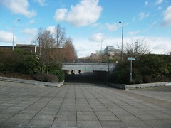 | 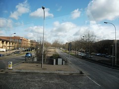 |
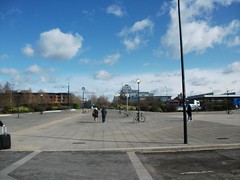
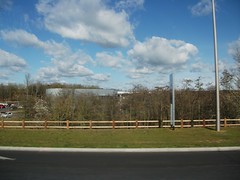
Milton Keynes has an outer gridplan, a large-scale (about 1km a side) checkerboard of horizontal and vertical "avenues" that deliberately avoid going to most of the places you might want to go. These aren't - or weren't in their original conception there seems to have been some withdrawal from the strict plan since and some shiny new shops and offices opening directly on to them - these aren't big shopping avenues or boulevards such as we think we know in Paris, they are more like internal bypasses, a complete network of roads that narrowly miss going anywhere interesting. So when you drive round the city you spend most of your time on dual carriageways with odd glimpses of buildings in the gaps between the almost-but-not-quite grown trees lining both sides of the road - and they are often not just single rows of street trees, they are deep plantings of parkland trees.
Its like a chessboard the lines between the squares represented by motor roads, and a roundabout at each place where the corners of squares meet. The actual places are in the centres of the squares, a different suburb or neighbourhood in each, and each one at least in potential distinct and different from all the others. Not that you can tell, because you can't see them. Commercial centres, new residential neighbourhoods, parks, older villages or towns, are all separate from each other and from the roads. The apotheosis of the "access without propinquity" fantasies of the 1940s to 1970s. Houses next to houses, shops to shops, offices to offices, everything ten minutes drive from a main road. No-one need meet anyone or anything they didn't plan to other than cars. Lots of tasteful shopping and green living in carefully segregated spaces. Victor Gruen come back to Europe and pupped.
 |  |